
Site mapping & surverying
Service Details
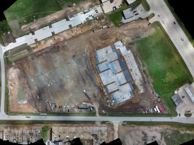
2D Orthomosaic Mapping
Enhance construction site tracking with precise 2D orthomosaic maps. These high-resolution maps are invaluable for monitoring progress, planning efficiently, and keeping everyone on the same page.
- Generate accurate maps to share updates with clients and subcontractors
- Identify issues early and improve collaboration across teams
- Integrate seamlessly with CAD and GIS software for advanced planning
These maps not only provide actionable insights but also double as an excellent communication tool, ensuring your clients and teams are always informed.